Just Puttzn' Around
Simulated LPC Experience
 No, Simulated LPC Experience, is not the name of a band, rather it’s the name of a new geocache here in Charlotte.
The ever creative RVStauff had an idea for creating a “puzzle” in VB that a cacher would have to download and solve before being able to find the actual physical cache. But after some discussion on the Greater Charlotte Geocaching Club’s forums (GCGC) it was decided that many people would probably not be willing to download and run an executable on their machine so I got with RVStauff to create his idea web based.
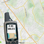
After seeing his original idea run as an actual program I immediately had a few ideas in my head of things to try. The first hurdle was that he had a static screenshot of a map and a picture of a GPS that would update a distance label depending on where you clicked. My mind immediately told me to implement this using the Google Maps API. Using the google map API I could start the user experience off by zooming out over the entire United states.
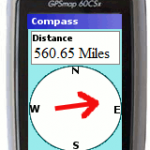
The challenge with what I had in mind was that I wanted an arrow that pointed in the correct direction to more fully simulate the “caching experience.” To get the effect I was looking for I had to implement a few great JQuery plugins. After all, why reinvent the wheel?
The most helpful plugin I used was JQuery Rotate. All it really does is take an image, or div, or any other type of element and rotate it. It was simple to use, and understand. Once I had this plugin installed all I had to do was get my arrow positioned correctly and let the rotating fun begin. Well, that is of course after I figured out the angle in which I needed to rotate it based on the click in the google map.
What came in handy when figuring out the angle was Google’s own geometry classes. by making a simple call to the computeHeading method I would quickly and easily have the data I needed in order to make the spin complete.
<br /> clickLoc = new google.maps.LatLng(35.1407667, -80.6243333);<br /> dest = new google.maps.LatLng(34.114667, -83.6255633);<br /> var heading = google.maps.geometry.spherical.computeHeading (clickLoc , dest ) ;<br /> //Depending on how you draw and originally place your arrow you may need to adjust the math on the rotation.<br /> $('#directionArrow').rotate(heading - 180);<br />
Now that the arrow was done, which I thought was going to be the hard part, I moved onto the distance. Once again Google saved the day with their google.maps.geometry.spherical.computeDistanceBetween method. None of this proved to be as challeneging as i thought, but I still learned a lot.
The second phase of this cache had users clicking what amounted to an HTML image map with 5 options, each of which have a different outcome. No real challenge here other than to semi obscure the final coords behind a php page that you users can’t freely get to without posting expected parameters. (I find this part boring so I’m not going to discuss it)
Lastly, RVStuaff wanted to try to find a way to simulate a log sheet. So I hacked up a quick and dirty way for this to happen. It all starts with the page initially loading. That load will prompt the user to enter their caching name which will be stored in a javascript variable. Once the user “find the cache” that name, the total number of clicks, and the date/time of the find is written to a file on the server. YES, a file, not to a database. Why? Because I was lazy and didn’t feel like implemented a whole UI to edit the “junk” names that come in, and I didn’t want to give anyone access to the backend database. All of this is once again done using php to append new records to the file. There is even an ugly interface for RVStauff to edit any erroneous, extra, or useless logs that may come in.
Well there it is. A Simulated LPC Experience. It may not be the prettiest UI in the world, but it is all there and it works.
What do you think of it?
| Print article | This entry was posted by puttzy on January 12, 2012 at 9:48 am, and is filed under Development, Puzzle and Games, Web. Follow any responses to this post through RSS 2.0. You can leave a response or trackback from your own site. |


about 11 years ago
Great idea.. I wish I could code like this……..
about 9 years ago
A really good answer, full of ratyinaloti!
about 9 years ago
/ Ole ese cuero de Ubrique! Geniales los sorteos del 2º aniversario, en este caso me gusta que sea un producto nacional de excelente calidad. Mi iPad quedarÃa muy guapo con una funda de Pielframa. Para los próximos sorteos no pido nada en particular pero me vendrÃa bien un stylus para dibujar en el iPad ; ) Saludos y feliz aniversario!
about 9 years ago
Part of me doesn’t believe that this is gonna be the end of their touring forever (while a part of me sort of does), but I’m sure they’re gonna take a little more of a lengthy break this time after these shows.
about 9 years ago
Well Anita & Eli I goofed I pressed the wrong tab so we will finish up We love you both for what you are doing and thank God that You all will be a witness for Him. We keep you all in our thoughts and prayers. Love You & Eli and enjoy your time there. Love Mom & Dad
about 9 years ago
Thankyou very very much for the wonderful job you have done. May God Almighty Bless you alyaws. Seeing the picture of Jesus just tells my concious to be good because I have received the immense Graces of Jesus Christ in my whole life and espesially when participating in the retreat that was held in Vettucaud in 1993 conducted by Divine Retreat Centre. Images alyaws influence our mind and body in a very big way and have been proved by scientists and doctors. Thankyou once again.
about 7 years ago
Good man! Look at nice offers for you.
http://bit.ly/2Pvd825
about 5 years ago
Nzdyjlz
info@chicboutique.lt
:
about 5 years ago
??????????? ??????? https://pinupsbets.com/
about 5 years ago
works of art.
about 5 years ago
book about the chess of love “, created by
about 5 years ago
from lat. manus – “hand” and scribo – “I write”) [1]
about 5 years ago
way. Handwritten book
about 5 years ago
Duke de Montosier
about 5 years ago
antiquities. These are the Egyptian papyri
about 5 years ago
A handwritten book is a book
about 5 years ago
this post https://porno150.com/category/%d0%b7%d1%80%d0%b5%d0%bb%d1%8b%d0%b5/
about 5 years ago
which is carried out by the printing
about 5 years ago
At the same time, many antique
about 5 years ago
55 thousand Greek, 30 thousand Armenian
about 5 years ago
number of surviving European
about 5 years ago
then only a few have reached us
about 5 years ago
handwritten by the author.
about 5 years ago
antiquities. These are the Egyptian papyri
about 4 years ago
new texts were rewritten
about 4 years ago
Europe, and in Ancient Russia
about 4 years ago
handwritten books were made,
about 4 years ago
among them acquired “Moral
about 4 years ago
new texts were rewritten
about 4 years ago
(palimpsests). In the XIII-XV centuries in
about 4 years ago
handwritten books were made,
about 4 years ago
handwritten books were made,
about 4 years ago
from lat. manus – “hand” and scribo – “I write”) [1]
about 4 years ago
handwritten books were made,
about 4 years ago
(palimpsests). In the XIII-XV centuries in
about 4 years ago
Century to a kind of destruction:
about 4 years ago
55 thousand Greek, 30 thousand Armenian
about 4 years ago
among them acquired “Moral
about 1 year ago
?????? Darknet – ??? ??????, ??? ??????????? ? ?????????? ???????? ????????? ?????? ?????? ????? ? ???????? ????. ??? “Kraken” is associated ? a multitude of ?????????? opportunities ? intrigue. ??? not just a website; ??? gateway ? ??????? ??? ?????????, ??? rules ? ??????????? regular network ????????????????.
kraken at ????